SERVICES
UAV SERVICES & MAPPING
Prepare for Advanced Air Mobility with high-resolution multispectral aerial mapping and expert consulting.
WHAT WE OFFER
UAV consulting services and prototyping for organizations of all sizes.
High-resolution multispectral aerial mapping to help cities make better decisions.
Efficient manufacturing options and a network focused on comprehensive UAV solutions.
HOW IT WORKS
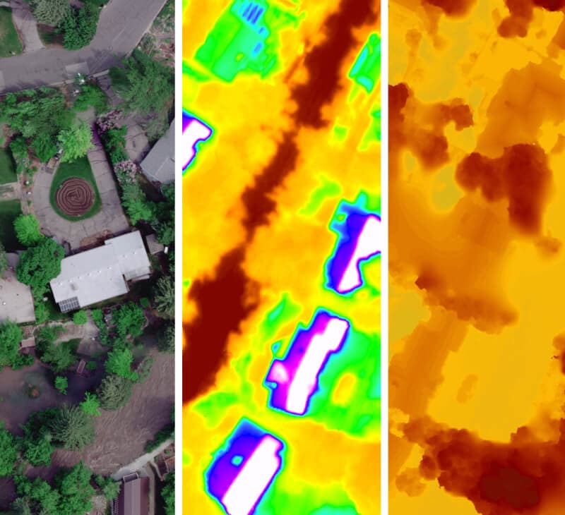
UAV mapping uses drones with cameras to provide accurate spatial imagery and data about an area. Drone-captured images are combined to create map-like 3D models.
KEY BENEFITS
Enhanced Safety
Eliminates the need for physical teams in dangerous terrain like cliffs, snowy peaks, or forests.
Speed
Scan acres of land within minutes, while manual surveys may demand hours.
Reduced Cost
Lowers operational and logistical expenses compared to traditional surveying methods.
Improved Data Quality
Drones capture thousands of measurements repeatedly for verification and accuracy.
APPLICATIONS
Topography Mapping
High-resolution terrain models for planning and analysis.
Construction Sites
Progress monitoring, volume calculations, and structure inspection.
Photographic Documentation
Aerial photography and video for documentation and marketing.
DATA PROCESSING
Enterprise-level drone data processing capabilities
READY TO GET STARTED?
Contact us for a consultation on UAV services and aerial mapping solutions.
CONTACT US